Wednesday, May 30, 2012

Ixtlán del Río

March 22, 2012

The Ixtlán del Río site is believed to have been established in about 300 BC and occupied until the arrival of the Spanish in the early 1500s.  I won't attempt to discuss the people who lived there and their way of life.  For us, it was a privilege to see the structures that remain and marvel at the skill of those who built them.


Wikipedia describes the most striking of the structures: 
  • One of these temples has a road paved with stone slabs, which leads to the round monument, discovered in 1948 by Prof. José Corona Núñez who eloquently describes his discovery, stating: "the round monument has 30 meters in diameter by 4 meters high;" sloped walls crowned by a perforated parapet with crosses, as if skylights, four access stairs . . . some of them still have cross shaped handrails.


I'll take the low road.

March 22, 2012

So we had this short and easy drive from Lake Chapala to Etzatlan (yeah -- see previous post) and the other part of the charm was that we were now just a few kilometers from the cuota, the toll highway, to the west coast.  And so we were.  We had just missed the tiny snippet of information that there is no interchange between the local roads and the cuota for another 72 km.  Aha.


Now -- I cut my driving teeth on narrow, winding roads. I recall taking fiendish pleasure in scaring townies as I sped along the Conception Bay Highway as it was in the late '60s between Holyrood and Brigus.  Just last year we drove thousands of kilometers of unpaved roads through northern Quebec and Labrador.  I had the misfortune two years ago of taking the wheel of the RV just before we started an hour of impossibly steep highway, complete with switchbacks, overhangs, spindly bridges and zero pull-offs as we approached Puebla from the east.

That said, Highway 15 from Magdalena to Ixtlán del Río set a new benchmark for sharp curves and moments of sheer terror as we seemed suspended in the air over a straight drop of staggering depth.  We dropped almost 2000 feet in the 90 minutes it took to accomplish the 70 km.  (Excuse the mixed measurements.)  Jim drove.  I took a single picture and after that held tightly to both armrests the entire time.  


Our ordeal was ending as we entered the town of Ixtlán del Río and we agreed Jim deserved a break.  Just at this moment we saw a sign indicating 'RUINAS' ahead.  Past experience told us this would be worth a stop.  Mexico has more archeological sites than we can fathom, some of which are not well know even within the country.  This was another unheralded gem.  


To begin, we visited a small interpretation centre that housed excavated sculptures dating over a period encompassing about 1000 years from 300 BC onward.  The sculptures were retrieved from shaft tombs, vertical wells where diverse sculptures were placed as offerings for the deceased.  Some of the smaller pieces were displayed in a cave-like setting so visitors could appreciate their original placement.


Doesn't this man look Asian?
We were delighted with our museum visit and ready to return to the RV when one of the employees pointed us in the direction of a laneway and sent us off to the main site. 


Sunday, May 20, 2012

Which way to Etzatlan?

March 21, 2012
Our aversion to driving in or around Guadalajara began the day in 2010 when we were trying to skirt around the city as we drove north to south. Our GPS guided us into the heart of the metropolis, spouted a few nonsense instructions, and then blithely announced, "No data is available for your current location."

This year we poked our nose into Guadalajara to buy building supplies at Home Depot. The navigator (me) missed a crucial turn and we spent the next 45 minutes trying to find our way back to the key junction.  Round and round we went.  The GPS would count down the kilometres and we'd be really close, possibly even in sight of that huge Home Depot sign.  Then, Jim would chicken out on a right-side merge down a steep sloop into a 3-lane lateral, and the km would start to ratchet up again.  Or the GPS did not account for an exit that had been closed off since the last map update.  At one exciting moment, we were driving along with four lanes of traffic in each direction, when the GPS instructed us to get into the left lane and announced, "left turn in 800 metres".  Oh sure.  But it was quite right -- there was a special overpass to allow hapless drivers to double back to where they should have been.  Exciting times.

[That day I did something I never did before in my entire life.  When we finally got to the store, I poured a shot of tequila and tossed it back before I could face shopping.  Don't tell Mother.]

My point is that we are utterly phobic about Guadalajara and would do anything to avoid a route that included the city's periferico or ring road.  How then to drive west toward the coast?  When we heard of a park in a rural Etzatlan that could be reached by travelling south of the city we decided it was for us.  It also made for a short run on our first day out of the Lake Chapala area.  Alas, less than an hour from our destination, Tomi (nickname for the female voice who torments us through our TomTom unit) took us on a creative shortcut.  The low point was when we found ourselves on an actual, literal cowpath.  We persevered (NEVER go back is my attitude) and got to a tiny crossroads.  An elderly woman and a young boy were quite unable to offer assistance.  I don't believe they understood us when we said 'Etzatlan', but in any case, people who don't drive cars are often unable to help with road directions.
Should have followed the sugar-cane truck.
I can say with some confidence that we were the first RV to navigate through several of the narrow lanes we traversed during the afternoon.  The total time we were off-road was not long, but it was a bit worrying.  Would we reach a place we could not get through and have to retrace our path?  Eventually we found ourselves in a village where some of the approaching traffic was bigger than Vagrant Van.  A little while later we connected with a wider road.  Saved again.


Delia's RV Park was a welcome sight.  It is run by a woman called Bonnie, so it had to be good.  It is a park in every sense -- trees, a grassy field and lots of animals.  Several of the resident dogs came to visit during the evening, once word got around that Jim was distributing treats.
Hard to spot, but there are two iguanas in this picture.


The horses were curious, but spurned my withered carrots.

Arizona or bust

March 21, 2012
Time to start our ~2500 km trek north to Arizona, where we will leave the RV for the off-season.  It was good to spend a final non-travelling week at Hacienda Contreras in the company of several couples we had met over the past few years.  This park has become a real magnet for Canadians, most of whom come from BC or Ontario, but this week we also had Nova Scotia and Saskatachewan represented.  Americans are fewer in number, here in the interior of Mexico, and probably in most areas except the northwest.

We weren't able to adopt a kitten to take with us.  Instead left this stone cat at Hacienda Contreras in hopes that Barb and Sal won't forget their first (and so far only) Newfoundland visitors.

As we started our trip out of the country, every encounter took on special meaning.  We stopped at a grocery store on the highway and I ran inside to get the usual staples -- milk, yoghurt (Mexican is best), bolillos (crusty rolls), local cheese, Squirt (my favourite soft drink to mix with tequila), frozen treats (more fruit than cream).  The young man working there had some English and with my bit of Spanish we had a real conversation.  Three years ago I would have been reluctant to enter the store.  Now, with enough Spanish to confidently greet the shopkeeper, ask for foods by name and understand the price, it was a breeze.  I also learned long ago that Mexican retailers don't bite.

Our route took us through the berry-producing area on the south shore of Lake Chapala.  Berries were 50 pesos ($4) for three 1-litre containers.  I wanted one each of raspberries, blackberries and strawberries, but there was a slight problem.  The raspberries weren't at their best.  The old man at the stall helped me choose a tub where the berries were not too mushy.  I paid him and then, as if to ensure that I was completely satisfied with my purchase, he thrust an extra litre of blackberries into the bag.  So sweet -- both him and the berries.
The first day's distance was fairly modest and we had a quick stop at Roca Azul to catch up on friends at the resort and note that the jacaranda tree was in full bloom.

Now, all we had to do was point the GPS to Etzatlan, weave our way through a web of secondary highways, and we'd be there in a couple of hours . . .


Hacienda fiesta

On March 18, Barb and Sal held a big party at Hacienda Contreras to mark the (almost) end of the season.  They invited friends, neighbours and family from Valle de Juarez as well as us campers.


We gathered on a beautiful, very windy, afternoon.  Food, drink, music and dancing were all on offer under the big tree.


Sal in charge at the barbecue.

This is dessert -- wow!
Don Quijote in his party outfit, grabbing a snack before giving rides to the kids.

Picture potpourri

March 14, 2012

Lots to take in this day.  After our visit to the lost church, we took back roads through mountain villages and experienced a sense of being far removed from the modern world.

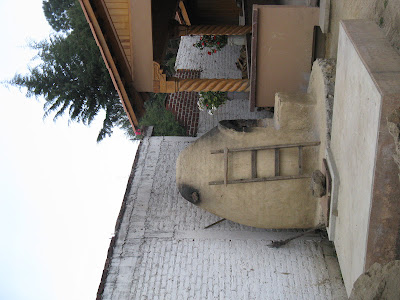
This outdoor oven in Angahuan looks as if it is still in use.


The cool boys outside the school high-fived me as we drove by.  Just a few kilometers down the road, this church and the women sitting outside could have been from a different century.


 The baskets and metates in the market opposite the church were outnumbered by the  stalls selling running shoes  and pirated  CDs and videos.

Cemeteries are nothing like home.  Monuments and mini-chapels are standard.  The dead are greatly revered and families spare no expense to honour them.  


Saturday, May 5, 2012

Indigenous style

March 14, 2012
In the course of our Mexican travels, it has not been unusual to see women dressed in a traditional fashion. Usually this would feature embroidered blouses and full skirts, often finished off with a shawl, variously called a serape or rebozo.  Older women may wear dark shades, but bright colours are common among all ages.

Angahuan is a small, rather isolated Purepecha village and we had heard that the women wore distinctive clothing.  The form their fashions took was a surprise; it was quite different from what we had seen previously.  


For me,the most striking part of the costume was the skirts.  They were full, below the knee, usually pleated and made from fabric which was often bright and shiny, like taffeta.  Over the skirt was an apron. Sometimes this looked utilitarian but frequently it was lacy or gauzy, perhaps what we would call a pinafore. With the skirt they wore a blouse (possibly pleated or in a floral pattern) and always a shawl. The shawl may be used as a head covering, especially on cold mornings, and often there will be a baby tucked inside.  Girls seemed to take on the shawl in their young teens.  The women's hair was braided and tied at the ends and sometimes also near the start of the braid.
This is the tail end of a very long line of women leading to an office (government?  health?) in the village. 


Good view here of the narrow pleats and also the hair braids.

I had an ethical dilemma in my desire to capture photos of the clothing.  Ordinarily I would not take someone's picture without asking permission.  When we spend time in a town we naturally come into contact with residents in the markets and on the streets.  It is a simple matter to ask by words or gestures if we may take a photo.  In this case we were driving through the town with no real interaction with the people.  I thought it would be terribly rude to stick the camera out the window and snap away.  So . . . not a lot of pictures.

A market in the plaza sold all the fancy fabrics for skirts and aprons.


Later in the afternoon we drove through a mountain village where all the rebozos were the same beautiful blue.

Angahuan and area

March 14, 2012
After our exploration of the encased church we had a special treat -- a lunch of blue tortillas with our choice of fillings.  There was a moment when I noticed that the women operating this stall had obviously arrived by truck.  I wondered why the option of driving in was not mentioned in any of the tourist literature we had read.  On the other had, approaching on foot through the woods had made quite an impact.  And the recommended road was about the worst we had ever driven.

Notice the metate or grinding stone.
The hike back up to the RV was a little more challenging than coming down, but still only took an hour.  (By the way, I suspect Lonely Planet was wrong is saying it was 2.8 miles. More likely 2.8 km.)

Along the way we saw lupins, just like those in our garden at home, sharing space with cacti -- none of which grace our property back home.


Vagrant Van was waiting for us at the tourist parking area and we took advantage of one of the fringe benefits of travelling by RV.  We were hot and sticky and our legs were black where the volcanic dust had stuck to the sunscreen.  No problem.  We had our shower with us so were squeaky clean before moving on!

The church that was swallowed by a volcano

March 14, 2012
Mexico is covered with mountains whose distinctive shape reveals their volcanic origin. Some of them have been dormant for eons while others still smoulder.


In 1943 the Paricutin volcano erupted in an agricultural region north of Uruapan.  The progression of the lava was slow, but over the next two years the villages of  San Juan Parangaricutiro and San Salvador Paricutín eventually had to be abandoned.  Visitors today travel to tiny Angahuan, which was saved due to its location high above the valley where the lava flowed.  From there it is possible to reach the lava fields on foot or on horseback.
The church at centre is our destination.
It was an easy downhill hike through a network of paths and unpaved roads, leading us through woods and past wildflowers.  As the route levelled out we encountered the hard black lava.  Soon the one remaining church steeple could be seen standing proud. 


Access was via primitive paths worn in the lava.  We climbed all around this extraordinary site.

The main altar was spared.  Each day fresh flowers appear and there are often small offerings and messages left at the base.
                   .


In some areas, flowers and shrubs are starting to take over.


We've admired dozens of beautiful, well-maintained churches all over Mexico.  None of our other visits was quite as moving as the experience of climbing through these ruins.


For more information on the lost San Juan church, see
http://www.mexconnect.com/articles/1116-paricut%C3%ADn-the-volcano-michoac%C3%A1n